Marcie’s Testimony about the Badger Bluffs goat prairie destruction

From: Marcie O’Connor

To: Board of Adjustments

I’m writing to request that you deny the Badger Bluffs Sands’ application because of their stated plans to destroy unique and fragile natural plant and wildlife communities on their property in the process of developing their mine.

Observations

  • This application proposes to destroy two possible bluff-top “Dry Prairies” (known locally as “goat prairies”) – habitat that is already under substantial pressure, unique to this part of the world, and a defining feature of our region.
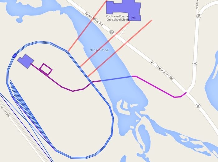
  • Destroying two prominent bluff-top prairies on two different scenic roads (Schoepps Valley Road and Oak Valley Road) is completely incompatible with surrounding land use.
  • The “Biological Resources, Plant Communities and Wildlife” section of the Badger Bluffs Reclamation Plan is deficient because while it identifies that the mine site possibly contains two Natural Heritage Inventory Dry Prairie openings, no professional survey of that unique and fragile habitat was conducted.
  • The Reclamation Plan is also deficient because it does not offer plans as to how Dry Prairie habitats will be preserved and protected during the life of the mine, and ignores the fact that once these habitats are destroyed they cannot be restored.

Background

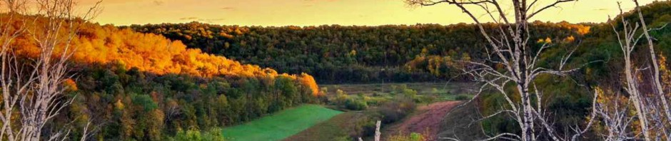
The mine will be located in what is known as the ‘Driftless Area’; the name refers to its glacial history.  The glaciers never covered this part of Buffalo County, and as a result it has rugged topography, and many unusual plants and animals.

One of the characteristics of this geology is steep, sandy slopes on many of the south-facing points of land.   These areas are identified as the “Dry Prairie community type” in the DNR Natural Heritage Inventory and are sometimes called ‘Goat Prairies’ around here.   Because their soil is sandy and the hills are steep, water drains away from them quickly.  Because they face south, snow melts quickly, and the sun beats down on them.  As a result, they are extremely hot and dry in summer, and cold and dry in winter, so plants must have unusual adaptations to survive there.

Goat prairies are one of the unique features of the Driftless Area, and of the landscape of Buffalo County. Each goat prairie is different – with its own unique mix of plants and animals.   Dozens of plant, animal and insect species interact with each other to make up each of these rare ecosystems, and many of the species are rare or uncommon in other places.

I am a naturalist and ecologist, with a degree in Botany and 20 years of experience restoring and managing native habitat.  For the last 13 years I’ve been working to restore the prairie, wetland and savanna landscape on our Buffalo County property.

Here are aerial photos of two Goat Prairies – one of the ones that will be destroyed by Badger Bluffs mining, and one on our land that appears to be very similar.   These Google Maps images are at the same scale.  The color variation is likely due to differences in the time of year of the imagery.

BBS2
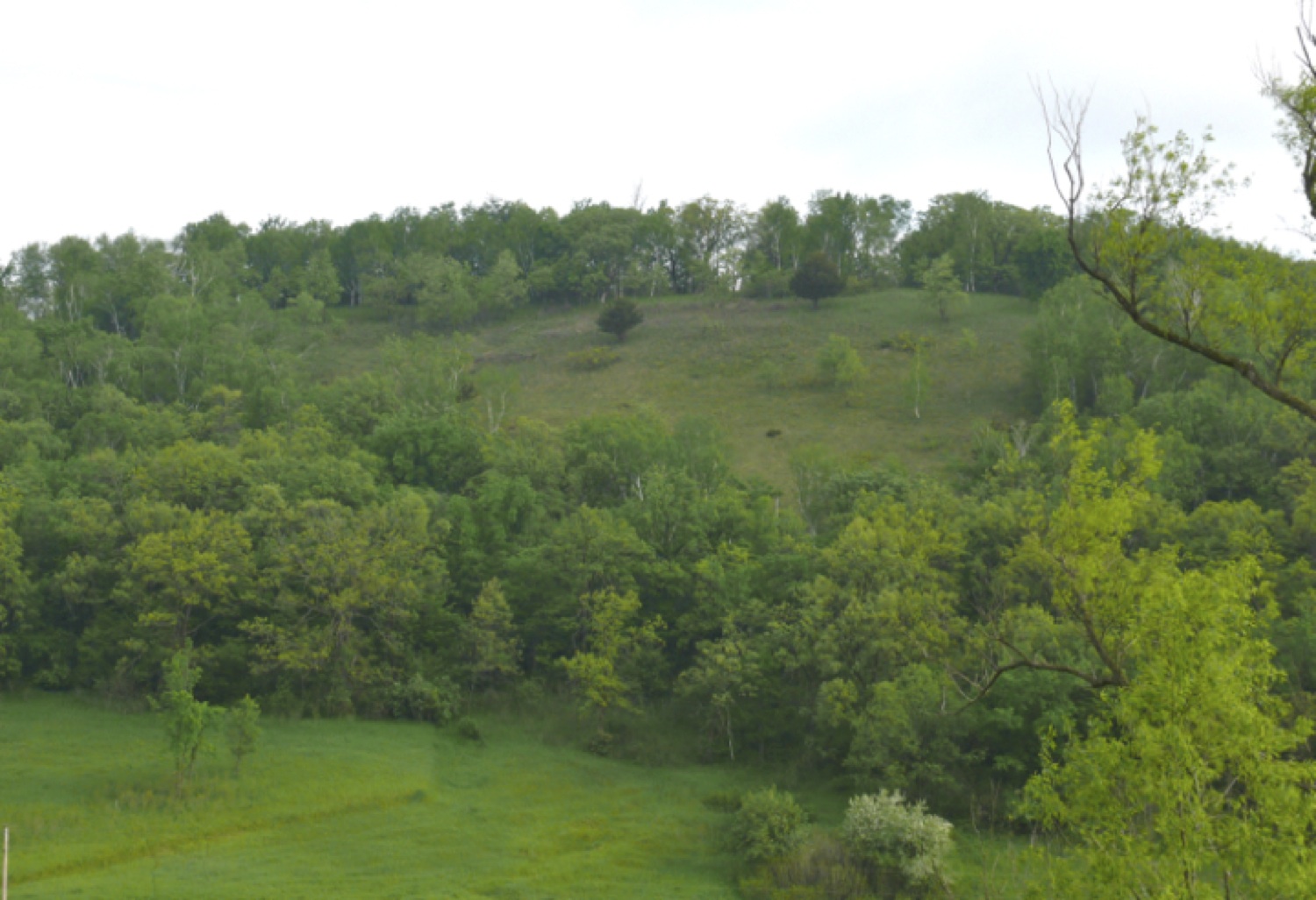
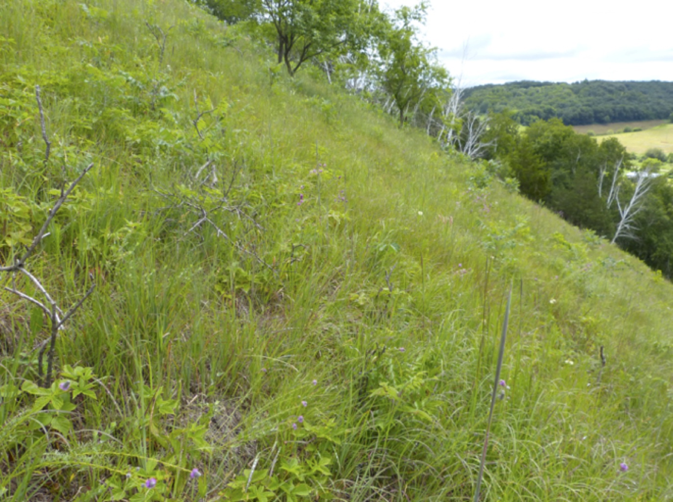
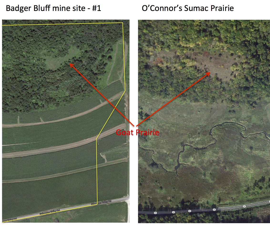
Here are some closer photos of our goat prairie, and a list of the plants I’ve found there.   Since the Badger Bluff Sands prairie is similar in size and also faces directly south, it probably has similar plant and animal communities.

O’Connors  Sumac Prairie

BB3

BB4

Inventory of plants found on Sumac Prairie

Agalinis aspera – Rough False Foxglove
Amorpha canescens
– Leadplant
Amphicarpa bracteata – Hog Peanut
Andropogon gerardii – Big Bluestem
Anemone cylindrica
– Thimbleweed
Antennaria neglecta – Field Pussytoes
Antennaria plantinifolia
– Plantain-leaved Pussytoes
Arabis lyrata
– Sandcress
Artemisia campestris
– Wormwood
Asclepias exaltata – Poke Milkweed
Asclepias syriaca – Common Milkweed
Asclepias viridiflora – Green Milkweed
Asclepias verticillata
– Whorled Milkweed
Aster ericoides
– Heath Aster
Aster oblongifolius
– Aromatic Aster
Aster oolentangiensis
– Sky-blue Aster
Aster sagittifolius – Arrow-leaved Aster
Aster sericeus
– Silky Aster
Aquilegia canadensis – Wild Columbine
Betula papyrifera – White Birch
Botrychium dissectum – Dissected Grape-fern
Bouteloua curtipendula
– Side-oats Grama
Bouteloua hirsuta
– Hairy Grama
Bromus kalmii
– Prairie Brome
Campanula rotundifolia
– Harebell
Carex pennsylvanica – Pennsylvania Sedge
Castilleja sessiliflora – Downy Yellow Painted Cup
Celastrus scandens – American Bittersweet
Cirsium discolor – Field Thistle
Comandra umbellata
– Bastard Toadflax
Coreopsis palmata – Prairie Coreopsis
Cornus racemosa – Gray Dogwood
Dalea purpurea
– Purple Prairie Clover
Draba reptans
– Common Whitlow-grass
Elymus trachycaulus – Slender Wheat Grass
Eragrostis spectabilis – Purple Lovegrass
Erigeron pulchellus – Robin’s Plantain
Fragaria sp. – Wild Strawberry
Hedeoma hispida
– Rough Pennyroyal
Helianthus occidentalis – Western Sunflower
Juniperus communis – Common Juniper
Juniperus virginiana – Eastern Red Cedar
Lespedeza capitata – Round-headed Bush Clover
Linum sulcatum
– Grooved Yellow Flax
Lithospermum incisum
– Fringed Puccoon
Lobelia spicata
– Spiked Lobelia
Monarda fistulosa – Monarda
Muhlenbergia cuspidata – Prairie Satin Grass
Oenothera biennis – Evening Primrose
Panicum oligosanthes
– Few-flowered Panicgrass
Prunus americana – Wild Plum
Prunus pennsylvanica – Fire Cherry
Prunus serotina – Wild Black Cherry
Prunus virginiana – Chokecherry
Pteridium aquilinum – Bracken Fern
Quercus alba – White Oak
Quercus macrocarpa – Burr Oak
Quercus velutina – Black Oak
Rhus typhina – Staghorn Sumac
Rubus flagellaris – Northern Dewberry
Sanicula marilandica – Black Snakeroot
Schizachyrium scoparium
– Little Bluestem
Scutellaria parvula var. missouriensis
– Skullcap
Senecio paupercula
– Balsam Ragwort
Sisyrinchium campestre
– Blue-eyed Grass
Solidago nemoralis
– Gray Goldenrod
Solidago ptarmicoides – Upland White Goldenrod
Sorghastrum nutans – Indian Grass
Spiranthes magnicamporum
– Great Plains Ladies Tresses
Sporobolus heterolepis
– Prairie Dropseed
Tradescantia ohiensis – Spiderwort
Viola x palmata
– Early Blue Violet
Viola pedata
– Bird’s-foot Violet
Viola pedatifida
– Prairie Violet
Zanthoxylum americanum – Prickly Ash
Zigadenus elegans – White Camas
Zizia aurea – Golden  Alexander

Insects

I haven’t done a formal survey of the insects on Sumac Prairie, but here are two unusual ones that I’ve seen there.

Chlosyne gorgone – Gorgone Checkerspot  (a prairie-dependent butterfly)

Cycnia inopinatus  – Unexpected Cycnia Moth (according to an assessment by James Bess at the USDA Forest Service: “[this moth is] primarily associated with high quality barrens remnants”)

Birds

Every year Golden Eagles come down from far northern Canada to spend the winter hunting on the goat prairies of the Driftless Area.  The National Eagle Center in Wabasha conducts an annual winter count of these birds.  Most years we record more Golden Eagles in Buffalo County than in any other Driftless Area county.

During the 2014 count (on January 18, 2014) there were 9 Golden Eagles sighted in the count area near the two Badger Bluff Sands goat prairies (the snowy weather this year made it difficult to see the eagles – in the past they’ve seen as many as 26 in this same area).

In most years the counters reliably see several Golden Eagles along Oak Valley road, and at least one pair of Golden Eagles in Schoepps Valley.  If we destroy our Buffalo County goat prairies, these magnificent birds may not continue to come here.

Inadequate survey methodology

It’s unfortunate that the Natural Heritage Inventory ‘survey’ of the Badger Bluff Sands site was not conducted by actually looking at the plants and animals at the site. The reclamation plan states that: “No sightings of this plant [the rare Hill’s Thistle] have been noted.”   But since no one with the expertise to recognize it has looked, it may be that that species, and possibly other rare species, are actually there.  Because of the unique habitats and special nature of the landscape, a professional naturalist should survey the site to determine if any of these species occur there, and if these areas deserve protection.

Restoration is not possible

I know from my experience in trying to reconstruct the prairie areas on our land, that it’s impossible to replicate the complexity and diversity of those original remnants.  Once a goat prairie is destroyed, it’s gone forever.   Looking at these photographs, I try to imagine destroying them to put a mine in their place.  Does that really seem like appropriate land use given the special nature of this beautiful landscape?

Land use

Another issue is whether we want to change the character of the Buffalo County landscape.  The driftless topography and vegetation make our county attractive to tourists and hunters.   Both the goat prairies on the BBS property face scenic roads (Schoepps Valley Road and Oak Valley Road), so the mining activities will be visible to everyone.

If we allow this to happen, we will begin to change the character of the countryside, making it less attractive for us to live in, and also to the visitors who support our tourist industry.   Few tourists will be interested in driving on roads where they see mines, rather than wooded hills and prairies.

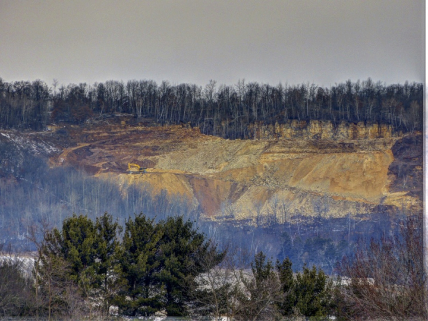
Here is a picture of the Segerstrom mine on Highway 37.  Imagine replacing two Dry Prairie openings with operations that look like this while the mine is in operation.  And know for a fact that there is no way to replace that dry prairie once the mining is done.

BB5

Appendix – Excerpt from Badger Bluff Sands Reclamation Plan

B. Biological Resources, Plant Communities, and Wildlife
(page 4, BBW Rec Plan Body)

“A search of the National [sic – should be “Natural”] Heritage Inventory (NHI) listed two species that may occur in the wet plant and Phase I areas, which are the Mud Darter (Etheostoma asprigene) and the Bald Eagle (Haliaeetus leucocephalus). The NHI listed six species for the Phase II and II I areas, which are the Pirate Perch (Aphredoderus sayanus), Mud Darter (Etheostoma asprigene), Weed Shiner (Notropis texanus), Hill’s Thistle (Cirsium hillii), Dry Prairie community type, and Wood Turtle (Glyptemus insculpta). The NHI list and Wisconsin DNR information on each species can be found in Appendix D.

“The Pirate Perch prefers the quiet waters of oxbows, overflow ponds, sloughs, marshes, ditches, and the pools of medium to large rivers, with sand covered or soft muck bottoms and or ganic debris present. The Mud Darter prefers moderate currents in sloughs, overflow areas, riffles, and pools of large, low-gradient rivers over bottoms of mud, sand, gravel, clay, or bedrock. The Weed Shiner prefers sloughs, lakes, and still-to-sluggish sections of medium streams to large rivers, over substrates of sand, mud, clay, silt, detritus, gravel, or boulders. It is possible that these fish could be found in Schoepps Valley Creek, but there are no plans of impacting the creek to disturb them. Storm water management measures will be taken to prevent runoff from the mine site from entering the stream.

“Dry Prairies are natural communities that usually occur on steep south or west facing slopes or at the summits of river bluffs with sandstone or dolomite bedrock near the surface. The mine site contains mostly forested areas and some agricultural land, but there are two locations that could potentially qualify as dry prairie. One is the south facing hill in Phase I, and the other is portion of the south facing hill in Phase III.  [note: there are no plans listed to survey or protect these areas]

“Hill’s Thistle is a state threatened plant found generally in dry prairies and oak barrens or in areas that contain dry, sandy soils. No sightings of this plant have been noted.

“Bald Eagles are a state special concern (fully protected) bird. They prefer large trees in isolated areas within proximity to large areas of surface water, large complexes of deciduous forest, coniferous forest, wetland, and shrub communities. No nests exist on or near the mine site, but there are sightings of them in the vicinity as they hunt for food.

Posted in General | Comments Off on Marcie’s Testimony about the Badger Bluffs goat prairie destruction

Glacier Sands — key information about what you can do

UPDATE:  TUESDAY 4-MARCH:

Because of your concerted citizen action throughout Buffalo County, Glacier Sands withdrew their application just prior to the County Board meeting.  Here’s their letter.  Several things to note — here are multimillionaire Texas oil men accusing you the many citizens of Buffalo County who wrote letters testified, voted and filed petitions of “tainting” the process.  The notion of glass houses comes to mind.

And they’re doing the same thing they did last time — they’re leaving the door open to return.  How can we miss them when they won’t go away?  Thanks to the thousands of you who participated in one way or another.  And remember…  “No means NO!”

Glacier withdrawlORIGINAL POST:

This is a post to summarize what you can do to help stop the Glacier Sands rail facility across from the CFC School

Read the application

Here’s a map of where this will go (clicking on this map will take you to a Google Maps map that you can explore).

Glacier map

Click HERE to download the whole application

Attend Meetings

(click on the date — we’ll post meeting details as we get them — no link means that we don’t know the time or location of the meeting yet)

  • Feb 11th, 2014, 6pm, CFC School Auditorium — Presentation by Glacier, no public comment (Zoning Committee)
  • Feb 13th, 2014, 6pm, CFC School Auditorium — Public comment, possibility of decision (Zoning Committee)
  • Feb 18th, 2014, 6pm, CFC School Auditorium — As-needed meeting to make decision (Zoning Committee)
  • Mar 4th, 2014, 7pm, Buffalo County Courthouse, 3rd floor Boardroom — Consideration by the full Board (County Board)

Subscribe to the email list

We will be posting information and alerts to the email list.  CLICK HERE to subscribe to the list.

Contact your County Board member

This lame-duck Board is ramming this proposal through just before a new Board is seated.  Let them know that you would like this vote to be delayed until the new Board (that is going to have to deal with the consequences of the decision) is seated in April.  The old Board is the wrong group to make this choice that will profoundly change our county for at least 20 years.  CLICK HERE for the list (and phone numbers) of the current Board members.  Note: the picture at the top of this Buffalo County website page is way out of date, but the list of names at the bottom is current.

Spread the word

Let people know what’s going on.  This is an exact repeat of last year’s attempt to put a major frac sand rail transfer facility directly across from CFC School at the junction of Highway 35 and 88.  Here’s a map — the arrows indicate where the trucks are coming from and where they’ll be headed.

Starkey


Posted in General | Comments Off on Glacier Sands — key information about what you can do

Lame-duck Zoning Committee prepares to rubber-stamp Glacier’s rail facility

As the pro sand-mining members of the County Zoning committee prepare to tiptoe off the Board and leave the rest of us with the wreckage of their decisions, they have one last treat in store.

The Glacier Sands transload facility is back and the Zoning committee stoutly resisted all attempts to defer the decision until the new County Board (the body that will have to cope with the consequences of their decisions) has been seated.

Instead, Tom Taylor rammed through a spectacularly aggressive meeting schedule that will bring the decision to the lame-duck Board on March 4th.  All done and delivered.  Here’s the proposed schedule:

  • Feb 11th — Presentation by Glacier, no public comment
  • Feb 13th — Public comment, possibility of decision
  • Feb 18th — As-needed meeting to make decision
  • Mar 4th — Consideration by the full Board

Yeah!  Now that’s responsive government!  Here’s a reminder-picture of what they want to approve.

Buffalo Country transportation hub

Posted in General | Comments Off on Lame-duck Zoning Committee prepares to rubber-stamp Glacier’s rail facility

MN Environmental Quality Board “Tools to Assist Local Governments in Planning and Regulating Silica Sand Projects”

Segerstrom 3Hi all,

The temptation to draw the comparison between Wisconsin and Minnesota on this issue is overwhelming.  Here in Buffalo County we cheerfully approve mines like the Segerstrom mine pictured above (which later went broke, leaving this hillside as a reminder).  In Minnesota, they’re being a little more thoughtful.

Here’s the “Introduction” section of Minnesota’s draft “Tools” handbook.  Click HERE to download the whole document.  Very useful material if you’re dealing with a sand mine in your area.  It’ll be harder for your opponents to make those “Google educated” “radical fringe” “global conspiracy” wisecracks they’re so fond of.

Minnesota Environmental Quality Board

Tools to Assist Local Governments in
Planning for and Regulating Silica Sand Projects

DRAFT DECEMBER 13, 2013

INTRODUCTION

In May 2013 the Minnesota Legislature adopted Laws 2013, chapter 114, commonly referred to as HF 976, now codified in Minnesota Statutes chapter 116C. Minnesota Statute 116C.99, sub division 2 requires the Environmental Quality Board (EQB) to develop model standards and criteria that may be used by local units of government (LGUs) in developing local ordinances regarding the mining, processing, and transporting of silica sand. This Tools to Assist Local Governments document fulfills this legislative requirement.

Authority to plan for and regulate land use activities rests primarily with local government. The EQB supports good local planning that articulates the future vision of a community. This should be supported with the adoption of sound local ordinances as the means to implement the planning. This document provides information that may be useful for LGUs when discussing issues related to silica sand.

The EQB strongly encourages each individual local unit of government to seek the advice of legal counsel in connection with the use of this document and its contents. The recommendations, standards, criteria, and considerations included in this document are not substitutes for local government planning and the contents of this document are not a substitute for legal advice.

The document is organized by topic. Each topic section or subsection discusses potential impacts from silica sand activities. Considerations for addressing potential impacts are discussed and then suggestions are provided on how to address the impacts.

This document is essentially a box of tools available for consideration by local governments. In some situations, there are several tools that may be chosen or used in conjunction with other tools to address a particular concern. The toolbox also includes instructions on how to use the tools themselves. As with any box of tools, the user should decide what is to be built before selecting a tool.

Two regions of the state were the focus of the statute: the Minnesota River Valley and southeastern Minnesota. These two regions are the areas most likely to experience the greatest effects of silica sand operations because they are where most of the sand exists. However, the toolbox can be applied to other areas of the state, where an LGU could compare its own circumstances to the geology, hydrology, and other characteristics discussed in this document.

This document is the work of staff from the Minnesota Department of Natural Resources, Minnesota Pollution Control Agency, Minnesota Department of Transportation, Minnesota Department of Health, Minnesota Department of Agriculture, and the EQB itself.

Local units of governments are not required to adopt any elements of this document and Minn. Stat. 116C.99 does not authorize the EQB or any other state agency to impose or enforce anything on local governments. The EQB and its member agencies are not enforcing or attempting to enforce the suggestions in this document as if they are duly adopted state rules.

It also is important to note that this document does not represent legal advice or legal opinions. The EQB assumes and recommends that an LGU will obtain appropriate legal advice before making any decisions to adopt or amend its official controls.

For reference, Minn. Stat. 116C.99 is included below in its entirety.

116C.99 SILICA SAND MINING MODEL STANDARDS AND CRITERIA.

Subdivision 1. Definitions. The definitions in this subdivision apply to sections 116C.99
to 116C.992.
(a) “Local unit of government” means a county, statutory or home rule charter city, or town.
(b) “Mining” means excavating silica sand by any process, including digging, excavating,
drilling, blasting, tunneling, dredging, stripping, or by shaft.
(c) “Processing” means washing, cleaning, screening, crushing, filtering, sorting, processing,
stockpiling, and storing silica sand, either at the mining site or at any other site.
(d) “Silica sand” means well-rounded, sand-sized grains of quartz (silicon dioxide), with very little impurities in terms of other minerals. Specifically, the silica sand for the purposes of
this section is commercially valuable for use in the hydraulic fracturing of shale to obtain oil and natural gas. Silica sand does not include common rock, stone, aggregate, gravel, sand with a low quartz level, or silica compounds recovered as a by-product of metallic mining.
(e) “Silica sand project” means the excavation and mining and processing of silica sand; the washing, cleaning, screening, crushing, filtering, drying, sorting, stockpiling, and storing of silica sand, either at the mining site or at any other site; the hauling and transporting of silica sand; or a facility for transporting silica sand to destinations by rail, barge, truck, or other means of transportation.
(f) “Temporary storage” means the storage of stock piles of silica sand that have been transported and await further transport.
(g) “Transporting” means hauling and transporting silica sand, by any carrier:
(1) from the mining site to a processing or transfer site; or
(2) from a processing or storage site to a rail, barge, or transfer site for transporting to
destinations.

Subd. 2. Standards and criteria. (a) By October 1, 2013, the Environmental Quality
Board, in consultation with local units of government, shall develop model standards and criteria for mining, processing, and transporting silica sand. These standards and criteria may be used by local units of government in developing local ordinances. The standards and criteria shall be different for different geographic areas of the state. The unique karst conditions and landforms of southeastern Minnesota shall be considered unique when compared with the flat scoured river terraces and uniform hydrology of the Minnesota Valley. The standards and criteria developed shall reflect those differences in varying regions of the state. The standards and criteria must include:
(1) recommendations for setbacks or buffers for mining operation and processing, including:
(i) any residence or residential zoning district boundary
(ii) any property line or right-of-way line of any existing or proposed street or highway (iii) ordinary high water levels of public waters
(iv) bluffs
(v) designated trout streams, Class 2A water as designated in the rules of the Pollution
Control Agency, or any perennially flowing tributary of a designated trout stream
or Class 2A water
(vi) calcareous fens
(vii) wellhead protection areas as defined in section 103I.005
(viii)critical natural habitat acquired by the commissioner of natural resources under
section 84.944
(ix) a natural resource easement paid wholly or in part by public funds
(2) standards for hours of operation
(3) groundwater and surface water quality and quantity monitoring and mitigation plan
requirements, including:
(i) applicable groundwater and surface water appropriation permit requirements
(ii) well sealing requirements
(iii) annual submission of monitoring well data
(iv) storm water runoff rate limits not to exceed two-, ten-, and 100-year storm events
(4) air monitoring and data submission requirements
(5) dust control requirements
(6) noise testing and mitigation plan requirements
(7) blast monitoring plan requirements
(8) lighting requirements
(9) inspection requirements
(10) containmentrequirementsforsilicasandintemporarystoragetoprotectairandwater
quality
(11) containment requirements for chemicals used in processing
(12) financialassurancerequirements
(13) road and bridge impacts and requirements
(14) reclamation plan requirements as required under the rules adopted by the
commissioner of natural resources

Subd. 3. Silica sand technical assistance team. By October 1, 2013, the Environmental
Quality Board shall assemble a silica sand technical assistance team to provide local units of government, at their request, with assistance with ordinance development, zoning, environmental review and permitting, monitoring, or other issues arising from silica sand mining and processing operations. The technical assistance team may be chosen from representatives of the following entities: the Department of Natural Resources, the Pollution Control Agency, the Board of Water and Soil Resources, the Department of Health, the Department of Transportation, the University of Minnesota, the Minnesota State Colleges and Universities, and federal agencies. A majority of the members must be from a state agency and all members must have expertise in one or more of the following areas: silica sand mining, hydrology, air quality, water quality, land use, or other areas related to silica sand mining.

Subd. 4. Consideration of technical assistance team recommendations. (a)When the technical assistance team, at the request of the local unit of government, assembles findings or makes a recommendation related to a proposed silica sand project for the protection of human health and the environment, a local government unit must consider the findings or recommendations of the technical assistance team in its approval or denial of a silica sand project. If the local government unit does not agree with the technical assistance team’s findings and recommendations, the detailed reasons for the disagreement must be part of the local government unit’s record of decision.
(b) Silica sand project proposers must cooperate in providing local government unit staff, and members of the technical assistance team with information regarding the project.
(c) When a local unit of government requests assistance from the silica sand technical assistance team for environmental review or permitting of a silica sand project the local unit of government may assess the project proposer for reasonable costs of the assistance and use the funds received to reimburse the entity providing that assistance.

EFFECTIVE DATE. This section is effective the day following final enactment.

Posted in General | Comments Off on MN Environmental Quality Board “Tools to Assist Local Governments in Planning and Regulating Silica Sand Projects”

R&J Mine — Appeal has been filed

Just a quick post to update you on the R&J Mine.  We lost the first round, and just filed an appeal.  Click HERE to read the filing.

Posted in General | Comments Off on R&J Mine — Appeal has been filed