NOTE: Please take a look at the very end of this post for the latest versions of the documents on file for this mine. Last update 2-April, 2014.
There’s a new application for a mine that you might want to learn about. Here are some highlights from the application:
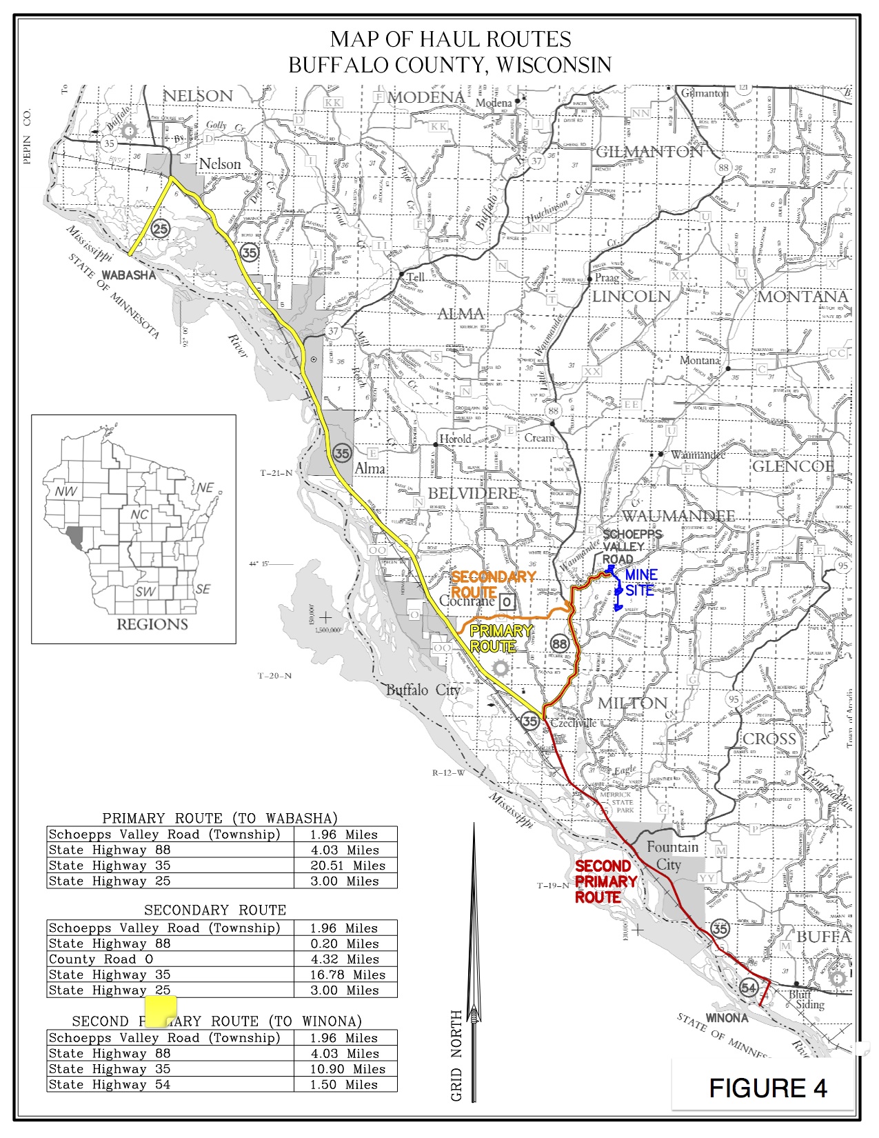
- 100 loads, 160 truck-trips a day running on Schoepp’s Valley Road to 88
- Hauling Monday through Saturday
- All the “primary” haul routes go through the 88/35 intersection by CFC School
- Trucks will most likely go through Alma, since Winona is closed to new sand
Given the distance to rail (minimum 20 miles, most likely closer to 30) and the small volume of the operation (600,000 tons/year max given the truck/day count) this mine is classified as a “small, high-cost operation” by industry analysts. So it’s likely future is that it will produce sand in boom times only, and will be idled the rest — a classic case of the commodity “flicker” effect where the jobs will be temporary and the damage will be permanent.
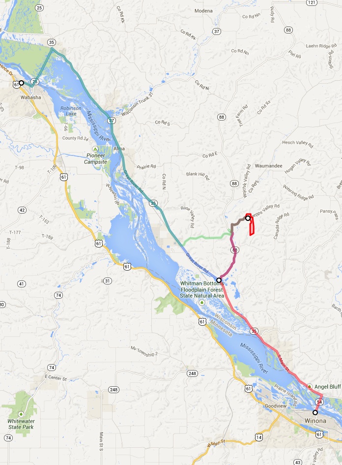
Here’s a map that I made of the site, based on their application – click on the map (or HERE) to visit the Google map which allows you to zoom in, look at haul route lengths, change to satellite view, etc.
Here’s a similar map, from their application — click on the map for a larger version.
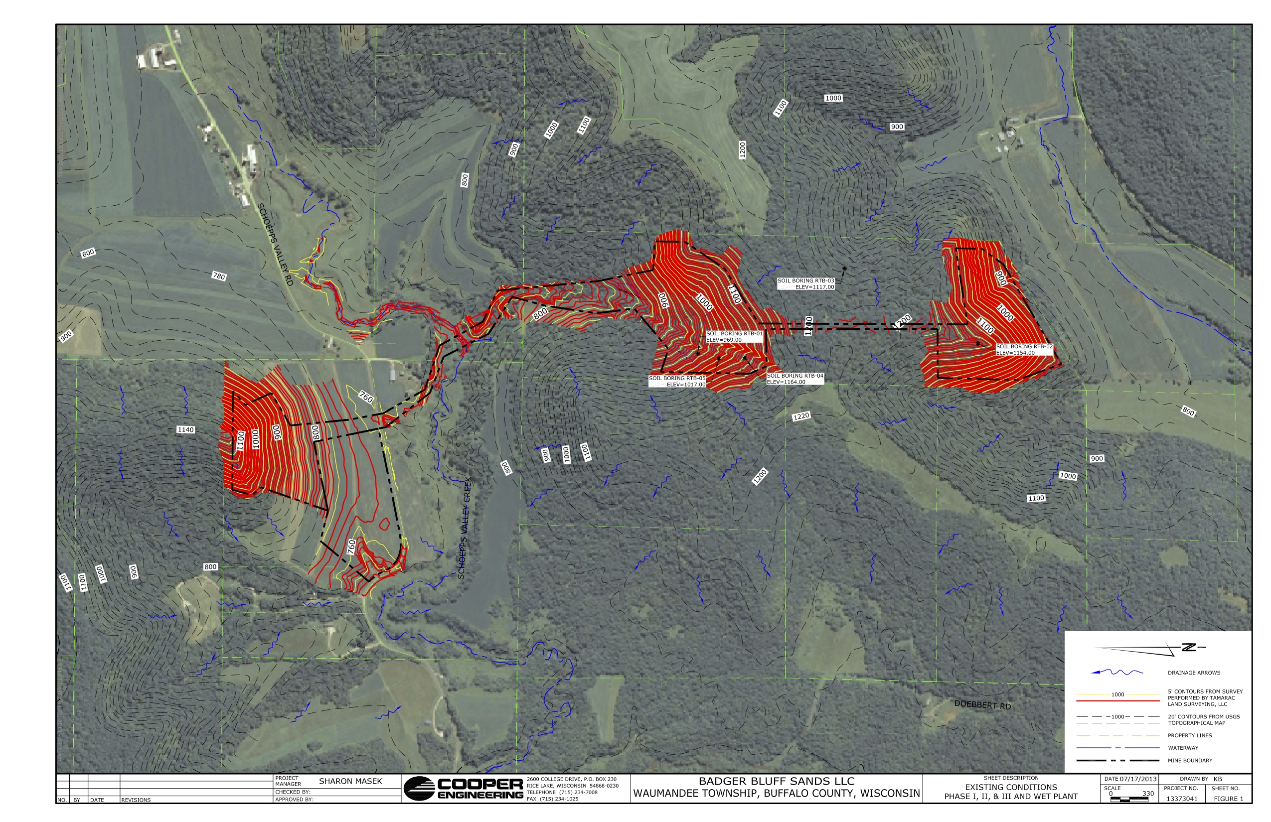
Here’s a close-up, showing the mine straddling Schoepps Valley Road, crossing the hill and ripping off a bluff facing on to Oak Valley Road.

Here’s a more detailed view (turned sideways — again, click on the picture to download a bigger version).
Click HERE to read the meat of the application.
Click HERE to download the whole thing, including all these maps and more (it’s pretty big, about 100 mBytes, so give it a while to download)
UPDATE – 22-January: here is a complete set of the latest materials about the mine
Rec Plan — Soil Info and Soil Boring Data
Rec Plan — Natural Heritage Inventory
Rec Plan — Groundwater elevations and well logs
Rec Plan — Traffic and road info
Rec Plan — WI Historical Society Records
Rec Plan — Hi Cap Well Application
WES-Badger Bluff Sands NMM 11-25-13
WES-Badger Bluff Sands-NMM Revisions 12-4-13
Additional Update: Here are additions filed in late March, 2014
Ambient Air Monitoring – AAMP air monitoring program
Ambient Air Monitoring – Air monitoring sites
Ambient Air Monitoring – TS ADR1500 air monitors
Flocculant Data – Biostar information